Manuel Antonio National Park Scenes
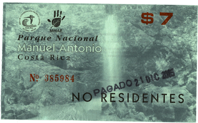
21 December 2005 - Winter Solstice
This page last updated 11 January 2006
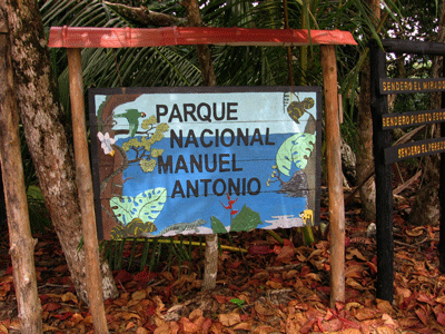
Manuel Antonio National Park is the jewel beach park of Costa Rica. It is entirely protected from development of any kind, and is guarded carefully but Costa Rica. This park provides opportunities to see a number of wildlife species, while sun bathing and swiming. In fact, if you leave your pack, bag, purse, lunch, or whatever on the beach while swimming, you will almost certainly be robbed, but the monkeys, or iguanas. We had one pack riffled through by a bold monkey when we visited in 2001, and were visited by large lizards while sun bathing.
Look at the first and fifth maps on my "Costa Rica Home" page to see just where Manuel Antonio National Park is. Basic information about Manuel Antonio National Park and the area can be found at this Manuel Antonio National Park website, or this other park info website.
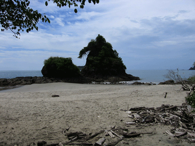
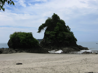
Manuel Antonio National Park, located just south of the town of Quepos consists of a beautiful tropical beach that features one large tombolo, and another smaller tombolo. This Costa Rica National Parks website
provides nice summaries and information about each of Costa Rica's national parks, including Manuel Antonio National Park. Go to my "Costa Rica Birds" webpage listed below to see a number of the birds I saw at Manuel Antonio National Park. This website has a nice little map of the park.
Our Caravan tour took us from the Amapola Hotel in Jaco south to Manuel Antonio National Park. The weather was perfect this day, the water was calm, and warm, and we beat the crowds.
CounterData.com

medicare Counter
All photos copyrighted by David L. Magney 2005.
Links to other Costa Rica photo pages
San Jose Area Photos
Poas Volcano National Park Area Photos
Braulio Carrillo National Park Area Photos
Tortuguero National Park Area Photos 1
Tortuguero National Park Area Photos 2
Grecia Metal Church and Sarchi Photos
Arenal Volcano Area Photos
Jaco Area Photos
Cloud Forest Photos
Rio Frio-Los Chiles Area Photos
Costa Rican Bird Photos
Costa Rican Butterfly Photos
Banana Plantation Photos
Costa Rica Home
Photos of the Manuel Antonio National Park Area
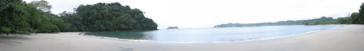
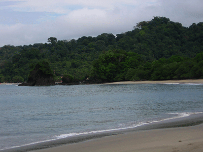
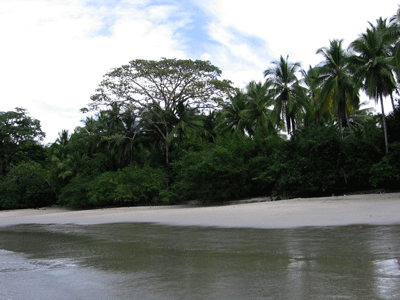
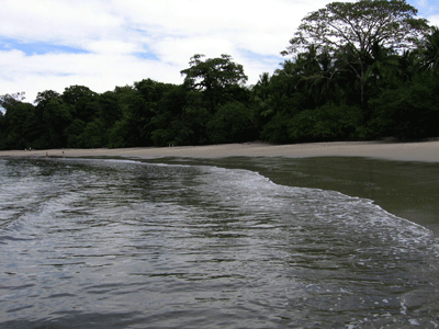
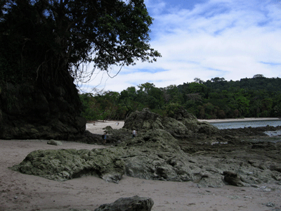
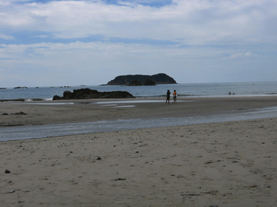
This is a panorama view of the beach just north of the Tombolo at Manuel Antonio (Espidilla Sur Beach). It is secluded when we arrive early in the morning. A Tombolo is a hardrock island that is connected to the mainland by a sandspit. This geographic feature is quite rare. A common Tombolo in California is represented by Morro Rock at Morro Bay in San Luis Obispo County.
But, the real adventure begins before even getting to Manuel Antonio, with true "E-ticket" rides crossing the bridges just to get to Manuel Antonio National Park. Below is a series of short video clips of two bridges we crossed. These, and other bridges in Costa Rica, are called "Oh My God!" bridges, as this is what the Costa Ricans say when crossing them. Neither of these bridges, and many, many others, would be kept open if they occurred anywhere in the United States. It is amazing that most have not already collapsed. Well, some have already. One bridge near the Osa Peninsula had collaped a short time before we had arrived on our April 2001 visit, requiring us to ford the river. The first video is very short, while waiting for the truck in front of us to cross this steel (okay, rusted metal) bridge. Many of the girders where not longer connected because of corrosion. The second video shows our bus following the truck across. I would have waited for the truck to cross completely before driving the bus onto it, to keep the weight on the bridge to a minimum.
![]()
![]()
![]()
At another bridge, we wait for two opposing trucks to cross this narrow, concrete planked bridge before crossing. Notice how uneven each concrete plank is? I will bet that this bridge will have collapsed by the end of 2006, and not from a flood washout.
![]()
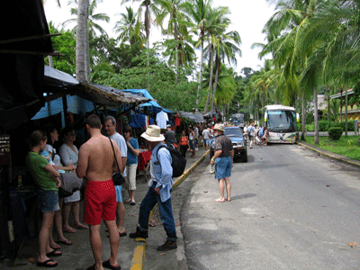
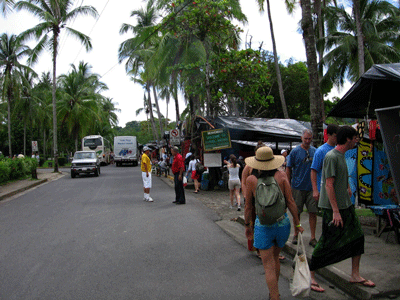
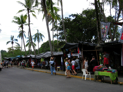
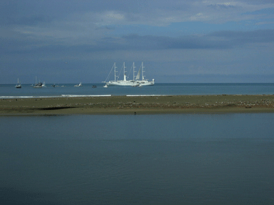
After arriving safely at the end of the road, just north of the entrance to Manuel Antonio National Park, we have an opportunity to browse any of the dozens of merchant tents lining the road, with the beach behind them.
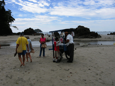
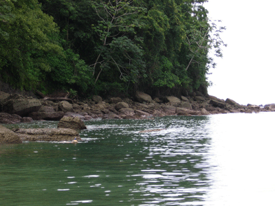
The first obstacle to overcome is crossing the mouth of the lagoon at the north end of the park. Locals bring in row boats to offer ferry those that don't want to get wet, for a price.
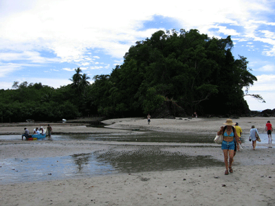
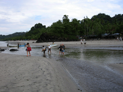
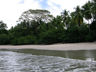
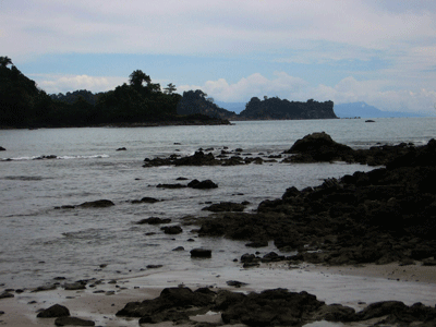
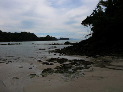
A couple of small Tombolos occur along the beach before getting to the beaches that are the destination of most visitors.
Here you can watch and listen to the small waves wash up the beach.
![]()
Scroll down for another.....after this one finishes playing.
![]()
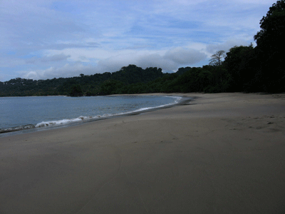
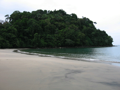
The beach we choose to swim at is all ours. We have beat the crowds and have it to ourselves, for the time-being (also see the panorama of this beach at the top of this page).
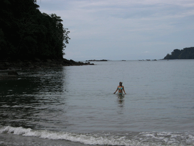
We have brought our snorkeling masks, and swim out among the rocks to see what fishes are there. The water is murky, but patience pays off, and we see a couple dozen species of marine fish.
![]()
And here Nancy and Heidy tell me what wonders of the sea they saw which snorkeling. Seen were starfish, pufferfish, and lobsters, oh, and two drowned rats.
![]()
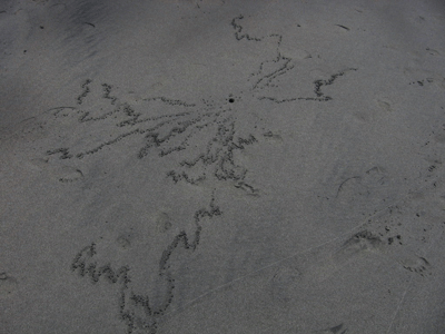
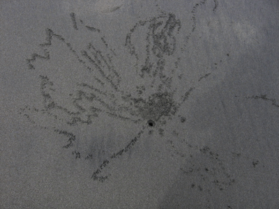
I noticed some strange patterns on the wet sand, and wondered what could have created them. Patience paid off. Watch closely as this crab is very wary.
![]()
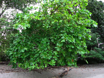
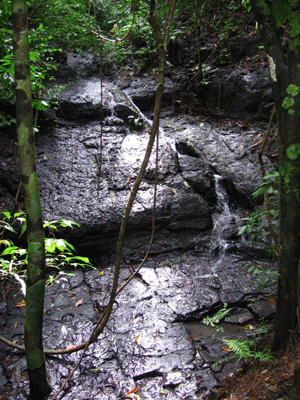
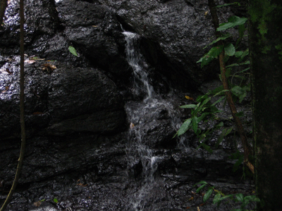
After our swim, we explore the Tombolo a little, and find a nice little waterfall.
![]()
Costa Rica Home
Photography Home Page
Photography Site Map
DMEC Home