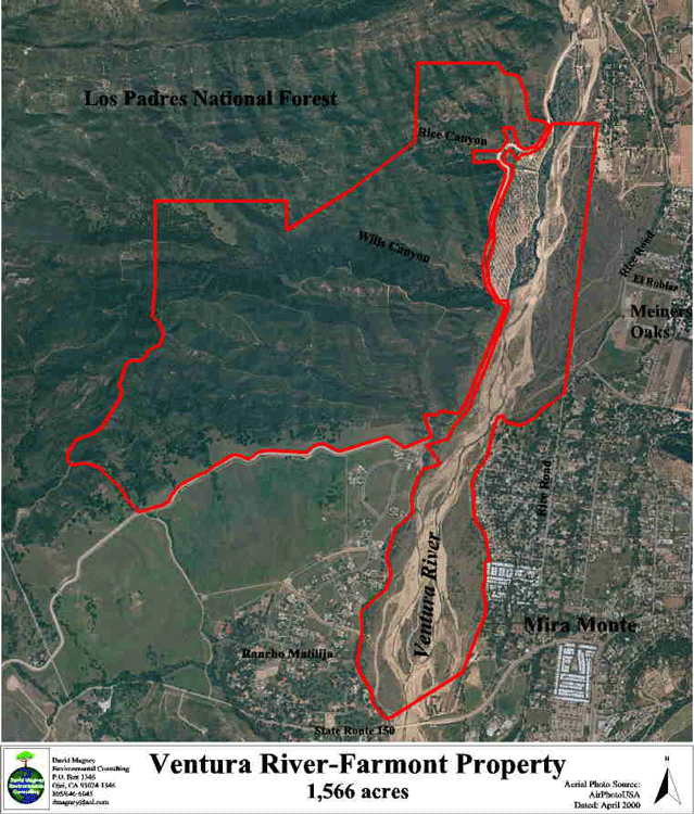
The Ventura River/Rancho El Nido Preserve is owned by the Ojai Valley Land Conservancy, purchased from the Intell-White Plains LLC, a development company, with funds from public donations and the California State Coastal Conservancy. The Intell property, originally the part of Rancho Matilija that was proposed to be developed into a private golf course and conference center known as Farmont, which had been approved conditionally by the Ventura County Board of Supervisors in the early 1990s.
The Preserve is 1,566 acres, consisting of over a mile of the Ventura River floodplain between State Route 150 north to the Robles Diversion Dam, and the foothills of the eastern end of the Santa Ynez Mountains, containing Rice and Wills Canyons, and intervening east-west trending ridges. Wills Canyon is the largest canyon on the Preserve, and is dominated by nearly pristine Coast Live Oak Woodland, with an intermittent stream flowing through it. A hike through Wills Canyon is pleasent even during the hottest days of summer, with the abundant shade provided by the mature oak trees.
All photos copyrighted by David L. Magney 2000-2005