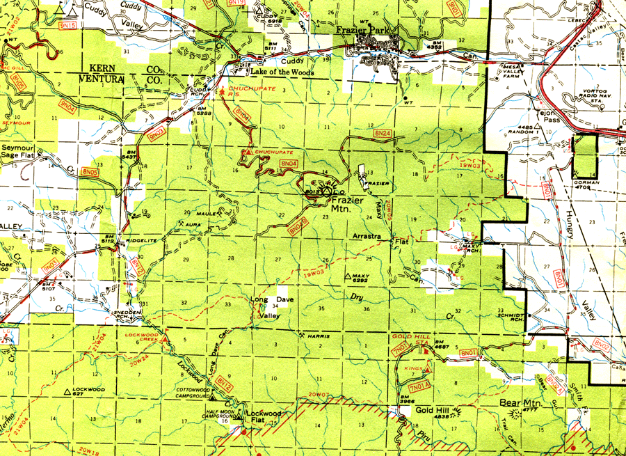
A Forest Service road (Frazier Mountain Road - 8N04) provides seasonal access to the top of the mountain. This road is accessed from Lockwood Valley Road about a mile from Lake of the Woods. It goes to the fire lookout tower and radio towers at the summit at 8,026 feet (2,446 meters) elevation, with spurs to the northeast (8N24) and southwest (8N04B), both connecting with hiking/biking trails to the east and south, respectively. Several trails radiate out from the summit, used primarily by dirt bikes. The northernmost portion of the mountain is located in Kern County.
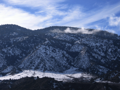
Wildfire is part of the natural dynamics of natural areas such as Frazier Mountain. The most recent fire to burn a significant portion of the mountain was the Day Fire of 2006. The Day Fire of 2006 (named for its start date on Labor Day) burned approximately 162,700 acres (6,5843 hectares), starting near Pyramid Lake in Los Angeles County to the southeast. The fire spread quickly and moved westward along the Piru Creek watershed primarily on the south slope of Frazier Mountain; however, it did not burn much of the mountain. There are no Ventura County Fire Department records of any fires on Frazier Mountain between 1950 and 2006. Natural fires on Frazier Mountain would be from lightening strikes. None have occurred on Frazier Moutain in over 60 years, at least not resulting in a wildfire.
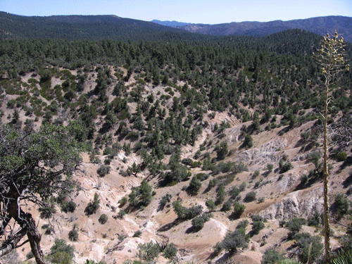
Frazier Mountain was created primarily during the orogeny of portions of the western Transverse Ranges, has been suggested as middle Pliocene (Axelrod 1976, 1980) and major deformation as middle Pleistocene (Gross 1958). Geologically, Frazier Mountain is composed of Precambrian igneous and metamorphic rock formations. The metamorphic rock is primarily Frazier Mountain augen gneiss, and is some of the oldest rock in California (Precambrian, at around 1.3 billion years old). Pockets of sedimentary rock occurs along the flanks of the mountain, and includes sandstone and siltstone members of the Pliocene Quatal Formation, and Pleistocene and Holocene landslides and conglomerates.
The basement rock of Frazier Mountain is basically riding up on younger material, pushed up along the North and South Frazier Mountain Thrust Faults, located on the south and west sides of the mountain. The San Andreas Fault occurring to the north and northeast, and the Big Pine Fault forms the west-northwest boundary.
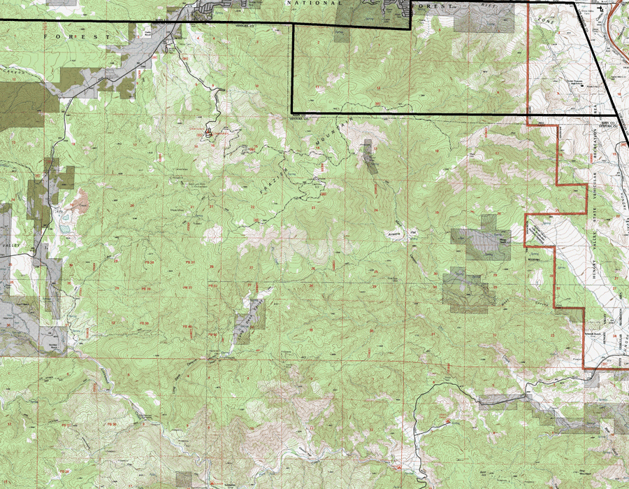
Frazier Mountain is located at the axis of the Transverse Ranges (of southern California), the Sierra Nevada, the Mojave Desert, and the Sierra Madre Range and Inner South Coast Ranges of coastal central California.
One primitative car camp occurs on Frazier Mountain (Chuchupate Campground), along the road from Lockwood Valley Road at the Mount Pinos District Chuchupate Ranger Station. The Forest Service used to maintain a fire lookout on the summit (which has been vandalized recently), with commercial radio and cell phone towers located nearby.
There are several old mines on Frazier Mountain, including: Aura, Maule, Frazier, and Harris mines. The Ridgelite mine (now owned by TXI) at the western toe of the mountain is still quite active, with its operations visible from Lockwood Valley Road, mining Lockwood Valley Clay.
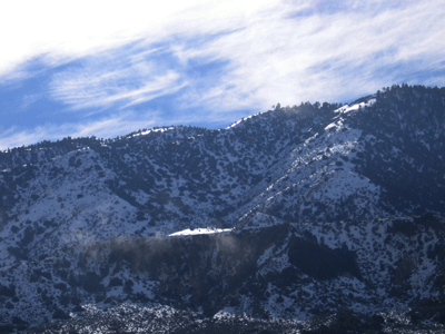
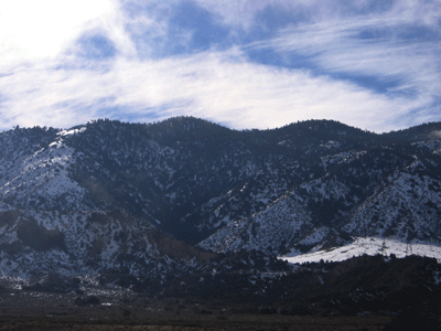
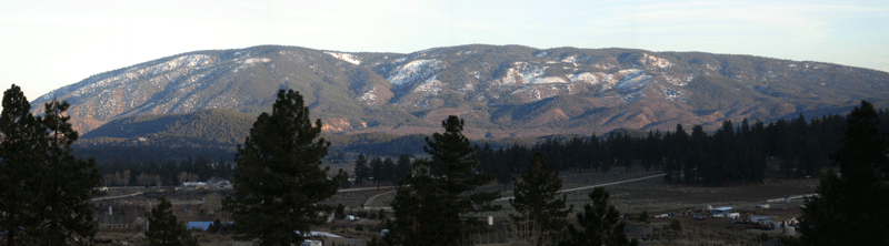
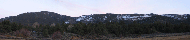
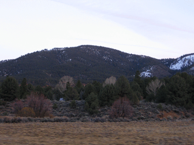
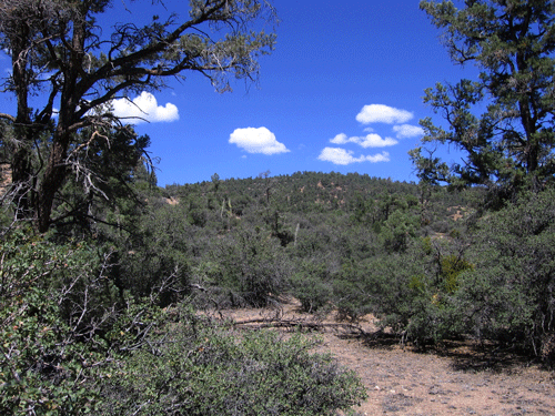
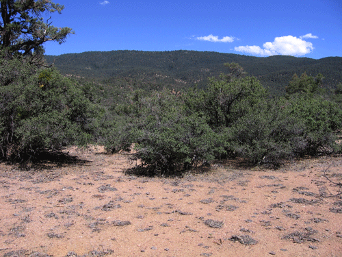
Frazier Mountain is located in the northern part of the Western Transverse Ranges, dominated by mixed conifer forests. The lower elevations of the mountain contain Pinyon-Juniper Woodland (Pinus monophylla-Juniperus californica Alliance) containing a significant amount of scrub oaks, including Quercus john-tuckeri (Tucker Scrub Oak). Higher elevations find Yellow Pine Forest (Pinus jeffreyi-Abies concolor-Quercus kelloggii Alliance), which generally has an open or scrubby understory. Montane Chaparral vegetation alliances occur in dryier and open areas on the slopes of the mountain.
The Frazier Mountain flora (a checklist of plants dated 23 October 2010) of the mountain consists of approximately 364 vascular plant taxa (including subspecies and varieties), complemented by lichens and bryophytes (mosses and liverworts). The flora is primarily holoarctic in floristic makeup, with a nearly direct topographic link to the Sierra Nevada through the Tehachapi Mountains. The flora is also influenced by the Madro-tertiary flora from the south. Of the 364 vascular plants on the checklist, 250 (69%) are supported by voucher specimens that have been deposited in one or more California public herbaria. 89 taxa (24%) have been observed on Frazier Mountain but are not supported by vouchers. Another 25 (7%) are expected but not supported by voucher specimens or direct observations by the author. No surveys of the lichen or bryophyte floras of the mountain have been conducted, that I am aware of anyway.
A large percentage of the Frazier Mountain vascular plant flora consists of plants that are rare in Ventura County. Of the 364 taxa documented as present on the mountain, including the 25 that are expected but not observed or proven yet, 147 taxa (40%) are rare, with 10 or fewer populations in Ventura County, or considered rare statewide or nationally or globally (Magney 2010), as published by the California Native Plant Society, Channel Islands Chapter. This is a lower percentage than for the county as a whole; however, it is still an impressive number. The relative uniqueness of the Frazier Mountain flora is a function of its geographic position in a floristically rich part of California, itself extremely rich floristically. Frazier Mountain has a range of habitats ranging in elevation from below 4,000 feet to just over 8,000 feet above mean sea level. While not quite subalpine like it neighbor to the west, Mount Pinos, it is almost as tall. Frazier Mountain has been riding northward on the Pacific Plate, bringing with it florisitic elements from hundreds of miles south, yet has a physical connection to migrating plants from the Sierra Nevada via the Tehachapi Mountains. Also of interest is the relatively small percentage of the flora that consists of non-native naturalized species, at 13 species, this represents only 3.6%, far below the average for the entire state or almost any area. It may be that this is an artifact of underreporting and collecting of naturalized species by botanists; however, my surveys of several transects, primarily on the south slope of the mountain, were floristic in nature, recording all species observed.
The Frazier Mountain region of Ventura County is also a genetic hotspot for wildlife in southern California, based on a recently published study in the journal, Biological Conservation. Vandergast et al. (2008) found that the Frazier Mountain area had a relatively high variance for genetic divergence based on a genetic study of 21 different species of wildlife, with representatives from invertebrates, amphibians, birds, mammals, and reptiles. This is in part due to the fact that Frazier Mountain is located at the crux of the San Andreas, Garlock, and Big Pine Faults, and the Tehachi Mountains/Sierra Nevada, Inner North Coast Ranges/San Rafael Mountains, Mojave Desert, and the eastern Transverse and Peninsular Ranges. This is a major factor explaining why this part of Ventura County is so biologically rich and diverse.