Ojai Valley and the January 2005 Flood
Created 24 January 2006
This page last updated 6 January 2008
This is the third page of scenes of flooding within the Ojai Valley, with this page focusing on the Ventura River and stream conditions a few days after the flood of 8-9 January 2005.
This webpage provides some photographs of what many of the streams, and Ventura River, looked like during the flooding, and before and after in some places.
CounterData.com

financial advisors Counter
All photos copyrighted by David L. Magney 2005-2006
Links to other Ojai websites
NOAA Weather website for January 2005 storms
Ventura County Watershed Protection District's website illustrating rainstorm data
Links to other Ojai Valley 2005 Flooding Pages - Ventura River
Ojai Flooding of 2005 Home
Ojai Flooding of 2005 Page 2
Photos and Video Clips of Flood Scenes in and Around Ojai
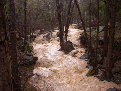
Above Wheeler Gorge, we see North Fork Matilija Creek filling its channel just before flowing under State Route 33. North Fork Matilija Creek is on of the largest tributary creeks feeding the Ventura River.
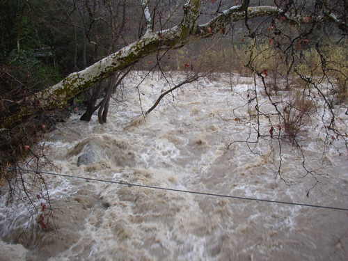
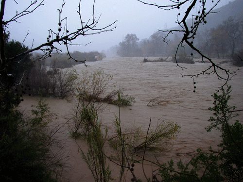
Then, we looked at the Ventura River mainstem, which is roaring away. This photo looks up stream showing the river at the Ojala footbridge crossing, at the upper end of the river proper, just below where Matilija Creek and North Fork Matilija Creek join to form the Ventura River.
![]()
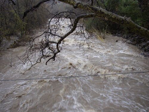
From the same position on the footbridge, looking downstream.
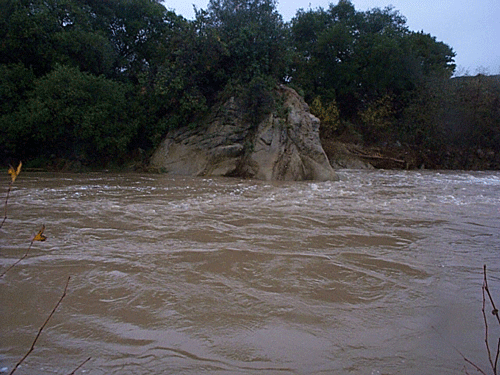
The Ventura River about a mile downstream, on the Ventura River/El Nido Preserve, the river is quite large, and very deep in some places, such as at the swimming hole rock. These photos are taken several days later then the rest, but staff with the Ojai Valley Land Conservancy.
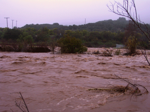
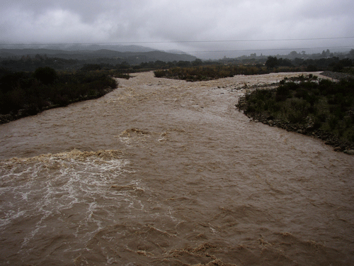
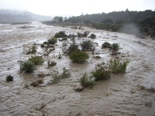
These shots are taken from the State Route 150/Baldwin Road bridge over the Ventura River, looking upstream (north).
![]()
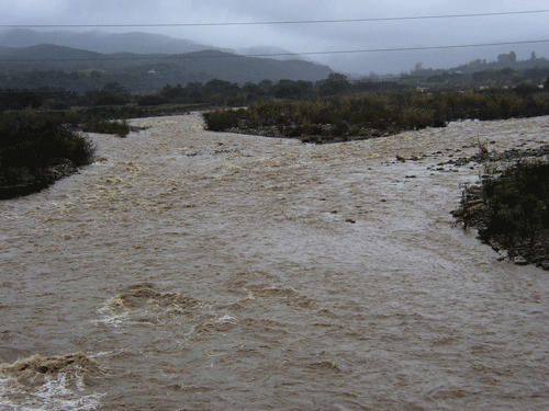
Then looking downstream, also from the SR150 bridge. This is the site of river habitat restoration paid for by the Ojai Valley Sanitary District when crews bulldozed several acres of riparian scrub in 1998 while repairing a broken sewer main and trying to beef up an unconsolidated levee on the right bank, all done without the benefit of a permit from the U.S. Army Corps of Engineers. This required after-the-fact permits to be obtained, and an habitat restoration plan prepared by David Magney Environmental Consulting, a plan that Corps staff say is one of the best they had received.
![]()
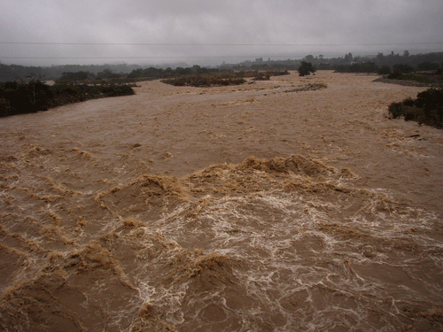
Much further downstream, on the west side of Foster Park, the river is even wider and deeper. The City of San Buenaventura's waterworks that washed away in the March 1998 floods and repaired, where washed away again, only 7 years later.
![]()
Ojai Area Home
Photography Home Page
Photography Site Map
DMEC Home