
| David Magney Environmental Consulting |
|
Environmental Reports |
|
|
Home |
|
USFWS Bitter Creek National Wildlife Refuge - Rare Plant and Floristic Survey, Kern/Ventura Counties October 2015 DMEC is conducting botanical surveys of the Bitter Creek National Wildlife Refuge, which is located at the western end of the San Emigdio Range in southwestern Kern County and a small part of northwestern Ventura County. The Refuge is approximately 14,097 acres of rolling hills and steep slopes bisected by the San Andreas Fault. The Refuge supports mostly herblands/grasslands, with Chenopod Scrub, Pinyon-Juniper Woodlands, and Alvord Oak Woodland, with scattered seep/spring and sag pond associated wetlands. Field surveys were conducted during the spring and early summer of 2015 over the entire refuge, looking carefully for federally listed plants. DMEC is contracted to conduct the botanical surveys for 5 years through the California State University, Stanislaus, to provide the resource information to the NWR resource managers. A total of 315 vascular plant taxa were observed at 1,176 data point locations. Ten special-status species were found during the surveys on various parts of the Refuge. Below is a PDF copy of the draft botanical survey report, "Flora and Rare Plants of Bitter Creek National Wildlife Refuge" (September 2015), covering the Bitter Creek NWR.
Richard Lyons - Mojave River Watershed Mitigation Bank October 2015 DMEC is assisting Mr. Lyons in developing a large wetland mitigation bank in the Mojave Desert at East Cronese Lake, which is located at the north central portion of San Bernardino County, just north of Interstate 15. The proposed Bank Site is over 400 acres, almost entirely within the bed of East Cronese Lake, which is the terminis of the Mojave River. The Bank Site supports Chenopod Scrub vegetation types, and extensive stands of Tamarisk, and invasive exotic shrub that will be eradicated to significantly improve wetland functions at the Bank Site. DMEC conducted a number of surveys and studies in support of applying to the U.S. Army Corps of Engineers, California Department of Fish and Wildlife, the U.S. Environmental Protection Agency, and the Regional Water Quality Control Board to establish a wetland restoration and preservation bank to allow Mr. Lyons to offer wetland credits to individuals and agencies that need to mitigation for impacts to wetland habitats and functions for projects in the Mojave Desert DMEC conducted surveys of the botanical resources, and performed a delineation of jurisdictional waters and wetlands. DMEC also developed a regional model to measure functionality of desert playa wetlands, using 19 different desert playas as reference sites, and used that model, following the Hydrogeomorphic Assessment Method developed by the Corps, to determine the level of functionality of the six depressional wetland functions of the East Cronse Lake Bank Site. DMEC also prepared a detail habitat restoration and monitoring plan for the Bank. These studies are summarized in a Prospectus, that is being used by the Interagency Review Team to evaluate the feasibility and appropriateness of estabishing the Mojave River Watershed Mitigation Bank. Below is a PDF copy of the reports prepared for the proposed mitigation bank.
Malibu Jewish Center & Synagogue - Tree Assessment, Habitat Restoration Plan, Wetland Restoration Plan, City of Malibu January 2014 through 2026 David Magney Environmental Consulting (DMEC) was contracted to conduct a biological assessment of the Malibu Jewish Center and Synogogue on PCH, Malibu, California. The center needed permits to upgrade existing temporary buildings and build a woman's chapel within previously disturbed areas while protecting regulated trees and ESHA habitat along Puerco Creek onsite. DMEC biologists surveyed the biological and wetland resources of the property, assessed numerous regulated trees (Coast Live Oak and California Sycamore), delineated jurisdictional wetlands onsite, and prepared a riparian wetland habitat restoration plan. DMEC found the undeveloped portion to contain two rare vascular plant species (Baccharis plummerae ssp. plummerae and Juglans californica). DMEC prepared a detailed tree protection plan and a riparian habitat restoration plan for Puerco Creek. DMEC is currently monitoring biological and trees onsite during construction activities, as well as implementing the riparian wetland restoration plan. Below is a PDF copies of the assessment reports and plans, for the project.
Sue Carter - Cayman Road, Malibu, Biological Assessment, Los Angeles County January 2013 David Magney Environmental Consulting (DMEC) was contracted to conduct a biological resources assessment and impacts analysis for the Carter property and proposed project at the request of property owner. The entire project site�s natural vegetation was burned by a wildfire most recently in 2018 (Woolsey Fire). The area of the Santa Monica Mountains containing the project site has burned several times: Sherwood/Zuma Fire (1956), Latigo Fire (1967), Dayton Canyon Fire (1982), and the Woolsey Fire (2018). The property is located in the upper reaches of Ramirez Canyon watershed, within the Coastal Zone of the Santa Monica Mountains. Sixty-four (64) vascular plants, including one special-status species, and 26 wildlife species were detected during the assessment. Below is a PDF copy of the biological assessment report, "Biological Resources Assessment for the Carter Property, 2545 Cayman Road, Malibu, Los Angeles County, California" (July 2023), covering the entire property. Weber - Rambla Pacifico, Malibu, Biological Assessment, Los Angeles County March 2008 David Magney Environmental Consulting (DMEC) was contracted to conduct a biological resources assessment and impacts analysis for the Weber property and proposed project at the request of property owner. The entire project site�s natural vegetation was burned by the Corral wildfire of 2007. The area of the Santa Monica Mountains containing the project site has burned several times: Sherwood/Zuma Fire (1956), Latigo Fire (1967), Dayton Canyon Fire (1982), and the Corral Fire (2007). The property is located in the upper reaches of Corral Canyon watershed, within the Coastal Zone of the Santa Monica Mountains. Seventy-five (75) vascular plants, including one special-status species, and 14 wildlife species were detected during the assessment, including one special-status invertebrate species Peninsular Shoulderband Snail Helminthoglypta traskii ssp. traskii. Below is a PDF copy of the biological assessment report, "Biological Resources Assessment and Impacts Analysis for the Weber Property, 2053 Rambla Pacifico, Malibu, Los Angeles County, California" (March 2003), covering the entire property. CRC Enterprises - Queen of Angels Catholic Church Biological Assessment, Santa Barbara County January 2013 David Magney Environmental Consulting (DMEC) was contracted to conduct a biological assessment of the Queen of Angels Church property in the Mission Hills area north of Lompoc, California. The Church needs to legalize previous lot splits and the County of Santa Barbara must comply with CEQA, hence a biological resources assessment was required. DMEC biologists surveyed the church property, half of which contains a church, school, rectory, and relative facilities, while the other half is undeveloped and containing Burton Mesa Chaparral, a rare plant community. DMEC found the undeveloped portion to contain six rare vascular plant species (Arctostaphylos purissima, Arctostaphylos rudis, Ceanothus cuneatus var. fasciculatus, Diplacus lompocensis, Horkelia cuneata ssp. puberula, and Mucronea californica) and a rich lichen flora. Interestingly, there were more species of lichen identified onsite then vascular plants, which is quite unusual. Below is a PDF copy of the biological assessment report, "Biological Assessment of Queen of Angels Church, Lompoc, California" (January 2013), covering the entire church property. Wild Wolves Preserve - Rare Plant Survey, Kern County July 2010 DMEC conducted a botanical survey of the lower elevation areas of The Wildlands Conservancy's 97,000-acre Wind Wolves Preserve in southwestern Kern County to determine the locations of rare vascular plants. The Preserve in located and very southern terminus of the San Joaquin Valley and up the north slope of the San Emigdio Range. Field surveys were conducted during the spring and early summer of 2010 over about 27,000 acres of the Preserve. DMEC was contracted to conduct the botanical surveys through the California State University, Stanislaus, to provide the resource information to the Wild Wolves Preserve resource managers. A total of 581 vascular plant taxa were observed at 200 locations. Six special-status species were found during the survey, and are documented at 33 locations on the Preserve. Below is a PDF copy of the botanical survey report, "Rare Plant Survey of the Wind Wolves Preserve, Kern County, California" (July 2010), covering the low-lying areas of the Preserve.
Tejon Ranch Conservancy - Lebec, Kern & Los Angeles Counties September 2009 The Tejon Ranch Conservacny, headquartered in Lebec, California, contracted DMEC to perform botanical surveys of five large aquisition areas of the very large Tejon Ranch, in the Tehachapi Mountains, in both Kern and Los Angeles Counties. The Tejon Ranch Conservancy wished to know what botanical resources were present, including special-status species, and vegetation alliances (communities) were present in each of the five aquisition areas, to be purchased in fee, or preserved through a conservation easement at some time in the future. The acquistions areas are known as: White Wolf, Old Headquarters, Michener Ranch, Bi-Centennial, and Tri-Centennial, totalling over 62,000 acres. Field surveys were conducted from mid-March through late July 2009, which was a very good year for wildflowers in the grassland areas especially. DMEC collected floristic and vegetation data at 342 data points across the five acquisition areas: 64 in Tri-Centennial, 91 in Bi-Centennial, 32 in Michener Ranch, 77 in Old Headquarters, and 78 in White Wolf. A total of 877 taxa were noted, of which 668 tax have been positively identified. Sixteen (16) special-status vascular plant species were documented in one or more of the acquisition areas. The vegetation consisted of 76 mappable/identifiable vegetation alliances, of which 39 are newly described based on DMEC's surveys. A PDF copy of the botanical survey report of the five Tejon Ranch areas, "Flora of the Tejon Ranch Conservancy Acquisition Areas, Tejon Ranch, California", is available below.
Lyons Canyon Ranch - Newhall, Los Angeles County September 2005 D.R. Horton - Western Pacific [Housing] Series proposed a residential development on the Lyons Canyon Ranch property in Lyon Canyon, located immediately west of Interstate 5, south of the Stevenson Ranch development, and north of Towsley Canyon Park. The Lyons Canyon Ranch project site contains portions of two Los Angeles County designated Sensitive Ecological Areas (SEAs): Lyon Canyon SEA 63 and Santa Susana Woodlands SEA 20. DMEC prepared the EIR for the project and has prepared a wetland delineation and biological constraints report for the project. The DEIR was made available in October 2006.
The project DEIR and all appendices can be found at DEIR Document Page. North Vineyard Greens Development Alternatives Analysis and Wetland Mitigation and Monitorning Plan August 2007 DMEC assisted developer Peter Daru obtain permits to fill wetlands at the proposed North Vineyard Greens development project site, located in the North Vineyard Station Specific Plan Area of southern Sacramento County, California, approved in 1998. The approved housing development will provide approximately 750 homes, single-family and multiple-family units in the middle of the specific plan area. DMEC prepared an Alternatives Analysis as required under Section 404(b)(1) of the Clean Water Act as part of the Individual Permit application to the U.S. Army Corps of Engineers (Corps) to fill at total of 1.60 acres of seasonal wetlands, including 0.15 acre of vernal pool wetlands. Based on that analysis, the Corps required 1.75 acres of onsite mitigation for impacts to seasonal wetlands (1:1 creation of non-vernal pool seasonal wetlands and 2:1 creation of vernal pool wetlands). DMEC then prepared the mitigation and monitoring plan to satisfy permit application requirements, proposing to create 1.75 acres of seasonal wetlands onsite in disturbed annual grassland habitat under existing electric transmission lines. Corps Regulatory Project Manager, Andrea Jones, wrote of the plan, "I am impressed with the thoroughly researched background information provided for context. This is a much more 'together' plan than I am used to seeing".
City of Ojai Urban Watershed Assessment and Restoration Plan August 2005 DMEC characterized all the streams and drainages within the City of Ojai and developed generic and specific stream habitat restoration projects intended to improve aquatic and riparian habitat conditions of the City's streams. This study was paid for with a grant from the California Department of Fish and Game in support of improving conditions for Southern Steelhead Trout in the Ojai Valley. This report has been converted to pdf and divided into sections for easier download. If you have difficulty viewing or downloading the complete report, please try one of the smaller sections.
City of Ojai Creek Road Repair Project - Natural Environment Study December 2007 DMEC prepared a Natural Environment Study to satisfy Caltrans/Federal Highways Administration grant requirements for the Creek Road repair project. The Ojai Public Works Department is planning to shore up the bank of Stewart Canyon Creek along Creek Road to prevent road failure during future flood events. DMEC surveyed the biological resources of the creek at the repair sites and described and documented existing biological resources, and made recommendations to mitigate for adverse impacts to biological resources. This study was paid for with a grant from Caltrans.
Point Broadcasting LLC - Biological Assessment for Proposed Anlauf Oil Field Radio Tower March 2011 DMEC prepared a detailed assessment of the biological resources of the south slope of Santa Paula Ridge for siting a new commerical radio tower to satisfy County of Ventura environmental impact assessment guidelines pursant to the Californai Environmental Quality Act. The Initial Study Biological Assessment was prepared according to the Ventura County Planning Division's biological assessment guidelines. The new radio tower is needed to fill coverage gaps in existing service for southwestern Ventura County, including broadcasting for emergency services. Jensen Design and Survey, Inc. performed the engineering and environmental permitting for Point Broadcasting LLC.
Environmental Defense Center-Sierra Club - Review of Oxnard 2030 General Plan and DEIR June 2009 DMEC prepared a detailed assessment and comment letters on the City of Oxnard's draft 2030 General Plan and DEIR on that plan. DMEC focused its reviews on the biological resource issues of the General Plan and Draft EIR on that plan. Particular emphasis was placed on the Ormond Beach area of Oxnard.
Dickinson - Yellowhill Road Property Revegetation Plan April 2007 DMEC prepared a detailed revegetation plan for Bruce Dickinson's property located at the top of Yellowhill Road, Santa Monica Mountains, Ventura County, California. This report was prepared to meet the requirements of the Ventura County Planning Division for past code violations resulting from vegetation clearing without a permit. The project site is dominated by Chamise Chaparral and Coastal Sage Scrub vegetation on the ridgetop south of Clark's Peak.
Malibu - Ramirez Canyon Biological Resources September 2006 Biological resources and impact assessment report for two adjacent proposed large single-family homes in lower Ramirez Canyon, Malibu, California. Attorney: Diane Matsinger, Esq. This report was prepared to identify biological resoucrce present at and adjacent to two development sites within the Coastal Zone, and to determine if and where Environmentally Sensitive Habitat Areas (ESHA) were present. DMEC also reviewed biological resources reports submitted to the City of Malibu by the applicant. The project sites contain ESHA Coastal Sage Scrub and two special-status plant species, Baccharis plummerae and Juglans californica ssp. californica.
Mountains Restoration Trust - Dry Creek and Headwaters Corner Wetlands June 2006 Mountians Restoration Trust was authorized by the U.S. Army Corps of Engineers, Los Angeles District, to use their Headwaters Corner property in Calabasas as a wetland mitigation site, using monies from offsite in-lieu mitigation funds collected by the Corps. Dry Creek flows through the Headquarters property and had been significantly degraded by historic land use activities. DMEC assisted MRT by conducting a delineation of jurisdictional wetlands, creating a baseline HGM wetlands functional assessment, and preparing a detailed wetlands mitigation and monitoring plan, all of which were approved by the Corps, and used to implement the restoration onsite. Archer - San Antonio Creek Endangered Species Monitoring May 2005 Preconstruction endangered species survey and construction monitoring report for a small project on San Antonio Creek, Ojai Valley, Ventura County, California. California Red-legged Frog, a federally listed endangered species, was found at the project site, and DMEC conducted preconstruction surveys to protect the frog. Thousand Oaks - Centex Development Wetland Delineation April 2005 Wetland delineation report for proposed housing development (Centex) at northwest corner of Reino Road and Maurice Drive, Newbury Park, Ventura County, California.
California State Coastal Conservancy Camarillo Regional Park Wetland Assessment August 2004 Wetland Functional Assessments (HGM) of the Camarillo Regional Park Wetland and Golf Course Project Scenarios, Ventura County, California. This study was conducted on behalf of the California Coastal Conservancy to identify expected direct and indirect affects to wetland functions resulting from implementation of four different project scenerios (two golf course project scenarios, and two wetland restoration project scenarios. DMEC used a regional HGM model to compare changes in wetland functions of the four project scenarios compared to baseline conditions. Calleguas Creek Watershed Wetland Restoration Plan October 2000 DMEC completed an intensive and watershed-wide study of existing wetlands within the Calleguas Creek Watershed in October 2000, and developed wetland restoration plans for several sites within the watershed. DMEC conducted this work for the Coastal Conservancy on behalf of the Calleguas Creek Watershed Habitat and Recreation Subcommittee through a grant issued to the Conservancy by the U.S. EPA. All data gathered for this effort have been input into a robust GIS database, using Arc/Info and ArcView 3.2 software. The Calleguas Creek watershed occupies the southeastern portion of Ventura County, California.
Harwood's Milkvetch Surveys, Chuckwalla Desert WMA September 2003 Harwood's Milkvetch Surveys, Chuckwalla Desert Wildlife Management Area, Riverside County, California
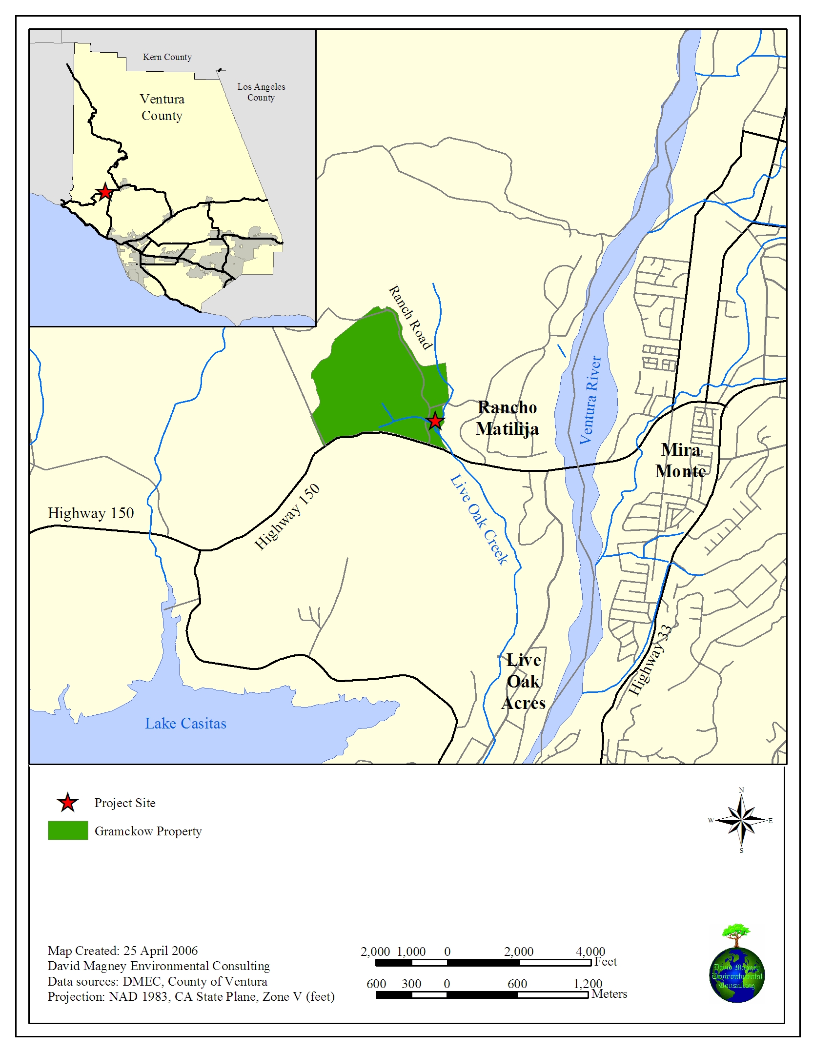
San Pedro Fuel Depot Rare Plant Survey August 2003 Rare plant survey report of Defense Fuel Support Facility, San Pedro (Palos Verdes Peninsula), Los Angeles County, California Gramckow Development Environmental Review Documents, Ojai Valley, CA May and July 2006 and March 2007 DMEC prepared environmental assessment documents for the Gramckow lot-split for Martin Gramckow at his property at Rancho Matilija, Ojai Valley, California, to satisfy Ventura County Planning Division (VCPD) permiting requirements. All reports (except CEQA documents) copyrighted by David Magney Environmental Consulting 2006. Mr. Gramckow desired to split an existing lot to create a seperate, developable lot on flat ground between two creeks. DMEC completed the Biological Resources CEQA Initial Study checklist for VCPD and used HGM to determine anticipated impacts of building a residence between two creeks to satisfy Ventura County General Plan wetland protection policies, which prohibit development within 100 feet of riparian wetlands. DMEC also conducted a wetland delineation of the property. Links to DMEC-Gramckow Documents
San Pedro Fuel Depot Rare Plant Survey August 2003 Rare plant survey report of Defense Fuel Support Facility, San Pedro (Palos Verdes Peninsula), Los Angeles County, California Newhall County Water District Vasquez Water Main Draft EIR August 2003 Draft Environmental Impact Report prepared by DMEC on behalf of NCWD's proposed water main extension to serve Vasquez Canyon Road area, Los Angeles County, California
Reinke - Conejo Creek Tributary Wetlands Fall 2001 Wetland HGM functional assessment report for project impacts and restoration of riparian wetlands of Conejo Creek tributary in Conejo Valley, Ventura County, California, and a detailed wetland mitigation and monitoring report.
Odyssey Program School - Las Flores Creek Wetlands Fall 2001 Wetland HGM functional assessment report for project impacts and restoration of riparian wetlands of Las Flores Creek in Malibu, Los Angeles County, California, and a detailed wetland mitigation and monitoring report.
San Marcos Foothills 1998 and 2004-2005 Botanical resources and wetland HGM functional assessment report for the Bridle Ridge development project (1998), Santa Barbara County, California, and critical reviews of the Preserve @ San Marcos project EIR and supporting documents (2004-2005) A Flora of Dry Lakes Ridge, Ventura County, California 1986 This book focuses on the vascular plant flora of Dry Lakes Ridge, in central western Ventura County, California. The ridge is entirely within the Los Padres National Forest, with the "Dry Lakes" supporting a relictual population of Ponderosa Pine (Pinus ponderosa var. ponderosa) from the Pleistocene era. The flora contains chapters on geography, topography, geology, botanical collecting history, plant communities, and an annotated catalogue of all the vascular plants known to occur on the ridge. The flora was published by the UCSB Herbarium. Copies of this book can be obtained by sending a check for $19.16 (includes sales tax and shipping) to CNPS (California Native Plant Society, Channel Islands Chapter) at P.O. Box 6, Ojai, CA 93024-0006. 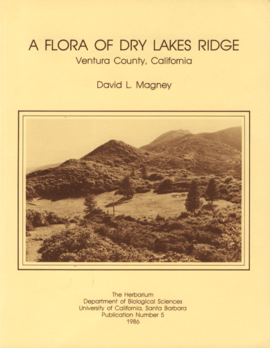
View My Stats |
|
|
Qualifications & Staff |
|
|
Client List |
|
|
Projects |
|
|
Reports |
|
|
Presentations |
|
|
Contact Us |
Mission Statement:
To provide quality environmental consulting
services with integrity that protect and enhance
the human and natural environment.
